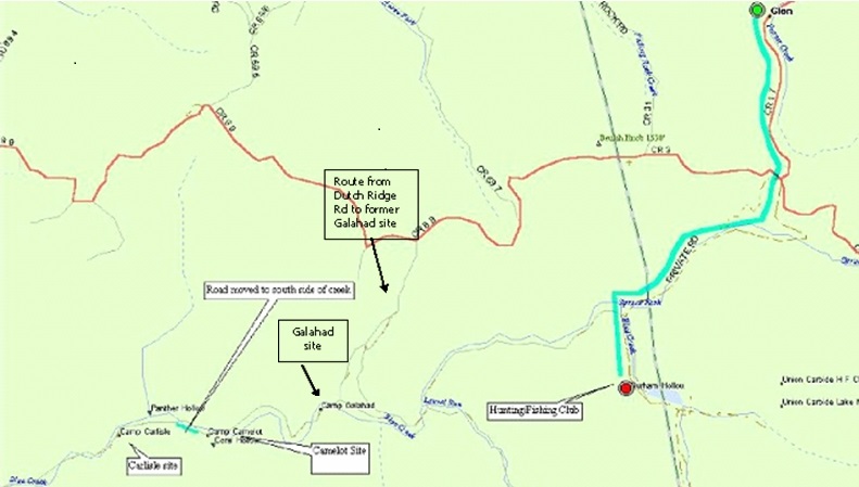
2015 Note: On this map, Dutch Ridge Road
(Co. Rd. 69) is the red road running east and west.
It turns into
Spruce Fork Road (Co. Rd. 3) toward the east side of the map.
Beware!
Google Maps and other mobile apps may, or may not show these roads.
There likely is only spotty cell-phone service.
Be prepared to be creative and careful!
The green
line shows the way from Glen to the Hunting/Fishing (H/F) Lodge.
After the steep
rocky hill south of the Dutch Ridge/Spruce Fork Rd. crossing, there are four
creek crossings
which should
be OK for a vehicle with good clearance, like a pickup or a sizeable SUV.
To get
to the Camelot and Carlisle sites from the H/F Lodge, it is probably best
to go back up to the
Dutch Ridge/Spruce
Fork crossing, turn left, and return to the Creek via the “walk-in” near
the Camp Galahad site.
The road
along the creek from H/F to Galahad is described as “really bad.”
So don’t try
it unless you are driving a capable 4-wheel-drive vehicle, or maybe a bulldozer.
Just downstream
of Galahad is probably the deepest Creek crossing we have to negotiate.
So, hope for
dry weather and come equipped!